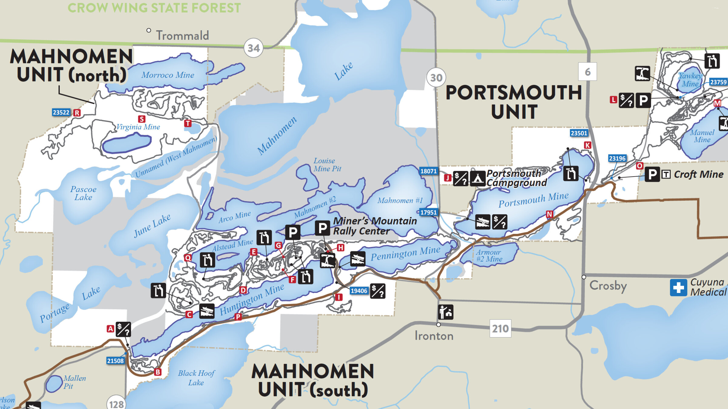
Map
Located in central Minnesota’s Crow Wing County, the Cuyuna Lakes State Trail is part of a state-wide network of official Minnesota State Trails. There are 25 such Minnesota State Trails, extending a full 1,500 miles, 620 miles of which, are paved.
At 9.2 miles long, the Cuyuna Lakes State Trail stretches from Riverton (46.4646 -94.0426) to Deerwood, (46.4764, -93.8991). Along the way, the Trail provides direct links to Ironton and Crosby, as well as mountain bike spur access to Cuyuna. In addition, the Cuyuna Lakes State Trail serves as a central artery, allowing on-bike access to many of the region’s renown mountain biking trails.
A map dedicated specifically to the Cuyuna Lakes State Trail, is pending. However, the Cuyuna Lakes State Trail lies predominantly within the Cuyuna Country State Recreation Area, which is well mapped. Find below a single-page segment of the Minnesota Department of Natural Resource's official Maps and Guide of the Recreation Area (circa June, 2022). Within this segment, you will find the Cuyuna Lakes State Trail as the bold brown line extending from Riverton in the lower-left, to Deerwood in the far-right. You may access the Maps and Guide in it’s entirety (eight pages, PDF format) by visiting the DNR’s webpage devoted to the Cuyuna Country State Recreation Area.
Like many other Minnesota State Trails, the Cuyuna Lakes State Trail is paved (fully 10’ wide) highly accessible, and multi-purpose, supporting a wide range of non-motorized activities. As such, the Cuyuna Lakes State Trail compliments the wide array of adjacent mountain bike trails found within the Cuyuna Country State Recreation Area as well as those found within the Crow Wing State Forest (Cuyuna Connector, Cruser‘s Kettle).
The difference between the Cuyuna Lakes State Trail and the mountain bike trails is easy to determine. The Cuyuna Lakes State Trail is wide, relatively flat and paved. The mountain bike trails are the opposite. They are narrow, cover varied terrain, and are never paved.
Cuyuna Country State Recreation Area - June, 2022 Overview
